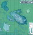
ၾၢႆႇ:Smits reef map.png

သႅၼ်းတႃႇတူၺ်းလူင်ႈၼႃႈ: 560 × 599 ၽိၵ်ႉသႄႇလ်. resolutionsတၢင်ႇဢၼ် : 224 × 240 ၽိၵ်ႉသႄႇလ် | 448 × 480 ၽိၵ်ႉသႄႇလ် | 717 × 768 ၽိၵ်ႉသႄႇလ် | 957 × 1,024 ၽိၵ်ႉသႄႇလ် | 1,913 × 2,048 ၽိၵ်ႉသႄႇလ် | 7,774 × 8,321 ၽိၵ်ႉသႄႇလ် ။
ၾၢႆႇငဝ်ႈတိုၼ်း (7,774 × 8,321 pixels, တၢင်းလဵၵ်ႉတၢင်းယႂ်ႇ ၾၢႆႇ: 6.41 MB, ယိူင်ႈ MIME: image/png)
ပိုၼ်းၾၢႆႇ
တဵၵ်းၼိူဝ် ဝၼ်းထိ/ၶၢဝ်းယၢမ်း တႃႇႁၼ်ၾၢႆႇ ၼႂ်းဝၼ်းၼၼ်ႉ
| ဝၼ်းထီႉ/ၶၢဝ်းယၢမ်း | ႁၢင်ႈလဵၵ်ႉ | သႅၼ်းမၼ်း | ၽူႈၸႂ်ႉတိုဝ်း | တၢင်းႁၼ်ထိုင် | |
|---|---|---|---|---|---|
| ယၢမ်းလဵဝ် | 19:46, 25 ဢေႇပရႄႇ 2021 |  | 7,774 × 8,321 (6.41 MB) | Pbsouthwood | Update 9m contour |
| 18:13, 30 မၢတ်ႉၶျ် 2021 |  | 7,774 × 8,321 (6.34 MB) | Pbsouthwood | another correction | |
| 18:10, 30 မၢတ်ႉၶျ် 2021 |  | 14,099 × 21,236 (9.37 MB) | Pbsouthwood | correction | |
| 18:06, 30 မၢတ်ႉၶျ် 2021 |  | 2,813 × 3,425 (1.88 MB) | Pbsouthwood | updates of Batsata reef | |
| 16:22, 3 ဢေႃးၵၢတ်ႉ 2020 |  | 7,774 × 8,321 (5.84 MB) | Pbsouthwood | updated wit more 12 and 15m contours at Batsata Rock | |
| 21:47, 20 ၸူႇလၢႆႇ 2020 |  | 7,774 × 8,321 (5.67 MB) | Pbsouthwood | Reef edge of Batsata reef added | |
| 23:33, 30 တီႇသႅမ်ႇပႃႇ 2018 |  | 7,774 × 8,321 (5.47 MB) | Pbsouthwood | perimeter of southern outlier and some 18m contours | |
| 21:52, 8 ဢေႇပရႄႇ 2018 |  | 7,774 × 8,321 (5.37 MB) | Pbsouthwood | updated with north west 24m contour and outliers | |
| 20:44, 26 မၢတ်ႉၶျ် 2018 |  | 7,774 × 8,321 (5.28 MB) | Pbsouthwood | completed 21m contour at Kreef Reef | |
| 23:38, 25 သႅပ်ႇထႅမ်ႇပႃႇ 2017 |  | 7,765 × 8,312 (5.23 MB) | Pbsouthwood | more 21m contour at Kreef reef |
လွင်ႈၸႂ်ႉတိုဝ်း ၾၢႆႇ
2 ၼႃႈလိၵ်ႈ ၵွင်ႉမႃးၸူးၾၢႆႇၼႆႉ:
လွင်ႈၸႂ်ႉတိုဝ်းၾၢႆႇလူမ်ႈၽႃႉ
Wikis ၸိူဝ်းဢၼ်ၸႂ်ႉဝႆႉ ၾၢႆႇဢၼ်ၼႆႉ:
- ၸႂ်ႉဝႆႉ en.wikivoyage.org
- ၸႂ်ႉဝႆႉ www.wikidata.org